News: 75-home plan: new transport and access documents
Consultants acting on behalf of James Painter have lodged additional transport and access documents for the proposed 75-home development in Chilbolton.
Main points
Perhaps responding to the observation by residents that the original transport assessment had been desk-based, Ridge consultants visited the Village as part of their updated analysis.
The two new documents contain:
- A Walking, Cycling and Horse-riding Assessment Report (WCHAR) which Ridge says “shows that the proposed development can be integrated into the village and that existing and proposed routes provide opportunities for active travel between the Site and village centre and village amenities”
- Accident data for the area around the proposed site, gleaned from Hampshire Constabulary, which shows “No slight, serious or fatal accidents were recorded within the study area over the most recent five year period available”
- Drawings setting out the three access points to the site
- Tracking drawings showing the paths taken by large vehicles to and from the site via the main access junction
- Ridge says that an independent road safety audit of the proposed access junction will be provided later
- They stand by their original residential trip analysis, but have updated it with trip data from the approved planning application for Test Valley Farm. They conclude that the proposed development will have a minimal impact on the operation of the local highway network
- Priority Intersection Capacity and Delay(PICADY) modelling of the access junction during peak hours which they say shows “no material impact to Drove Road”. They claim that it predicts “a delay of 6.65 seconds per vehicle and a negligible queue”
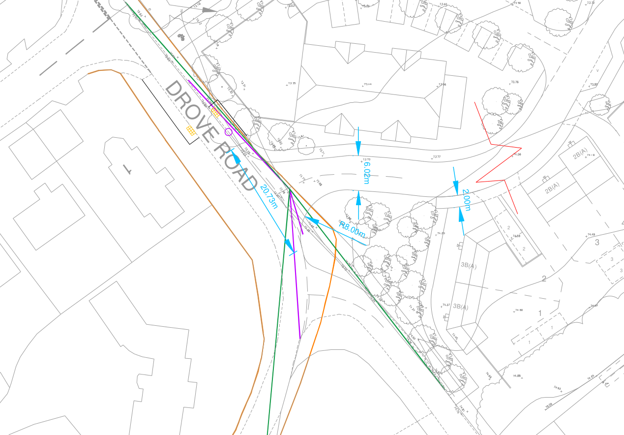
Drawing of access from Drove Road (Credit: Ridge)
Eastman’s Field
The new documents contain some cheer for the residents of Eastman’s Field. The documents say that “Ridge clarified in January 2026 that the Eastman’s Field Access was via an existing agricultural access with the intention being that this would be pedestrian, cycle and emergency access only to provide a link to the Village Hall.”
It is believed that this clarification was made during discussions with Hampshire County Council Highways officials rather than to the Parish Council or on the TVBC webpage for the application.
Vehicle access from Eastman’s Field to the development site would be governed by two lockable bollards
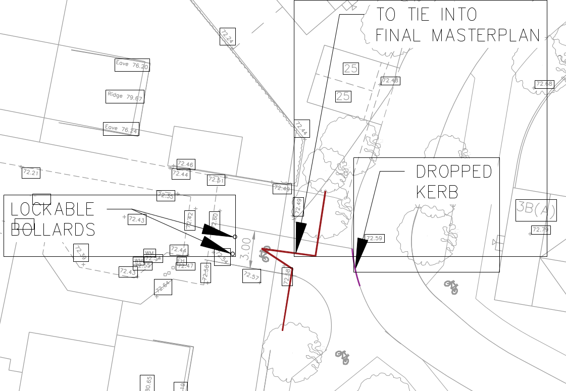
Drawing of access from Eastman’s Field (Credit: Ridge)
Cycleway/footpath
The proposed cycleway/footpath is set out in more detail than the original application. It would be 3 metres wide and would run to the northern-most edge of the field in which the development is sited. The access onto Cart Lane would be made through a new gate, set back from where the existing one is, together with two pre-cast, reinforced concrete bollards.
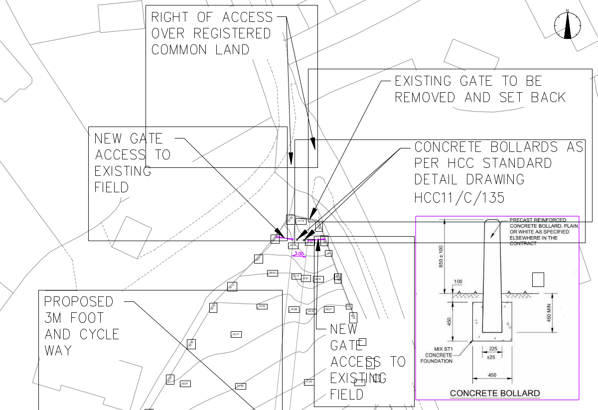
Drawing of access from Cart Lane (Credit: Ridge)
As with the original plan, there would be no access from the development site to Cart Lane, other than via the new cycleway/footpath.
Observatory
Interestingly, the consultants also reveal that “A meeting took place between STFC (the owners of Chilbolton Observatory) and Ridge on 13th of January 2026 to discuss the proposals. We await further comment back from STFC on any possible impacts of the development on the observatory.”