Analysis: How low does the beam go?
Pager Power have produced an interesting analysis for James Painter of the beam emitted from the Chilbolton Observatory main antenna.
It deduces that it will clear the roofs of his proposed development by at least 12 metres. But does this fit in with what the Science and Technology Facilities Council say themselves about their equipment?
The Pager Power analysis
Pager Power have selected five locations within the proposed development site.
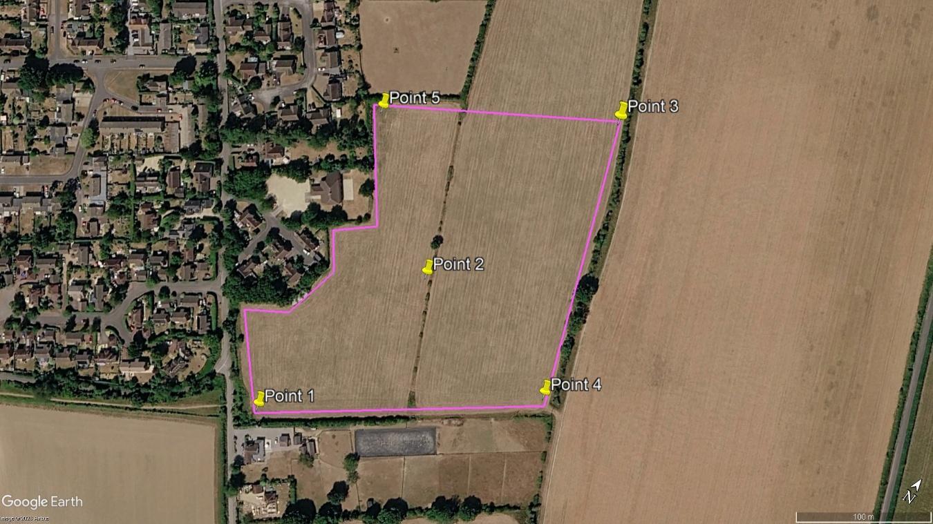
Five sites within the proposed 75 home plot (Credit: Pager Power)
All of these sites would be visible from the Observatory, but they point out that what matters is whether the buildings would interfere with the radar beam from the antenna.
A diagram shows their assumptions about the path of that beam:
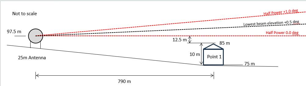
Path of the radar beam in Pager Power’s analysis (Credit: Pager Power)
The result, in their analysis for each of the five sites, is that the beam clears the top of these 10 metre high houses by 12.5 metres or more.
| Point | Elevation | Clearance |
|---|---|---|
| Point 1 | 75 | 12.5 |
| Point 2 | 72 | 15.5 |
| Point 3 | 72 | 15.5 |
| Point 4 | 74 | 13.5 |
| Point 5 | 71 | 16.5 |
The analysis relies on three assumptions:
- The source of the beam is at an elevation of 97.5 metres above sea level
- The centre of the beam is angled up by 0.5 degrees
- The bottom of the beam is level, 0.5 degrees lower than the centre
The question is, are these assumptions appropriate, and is there any better information available?
An alternative analysis
One of the frustrations that Mr Painter’s consultants, Southern Planning Practice, express is a lack of engagement from the Science and Technology Facilities Council, and a lack of hard facts from them. Facts which could be challenged.
However, there is information publicly available which might cast some light on the issue.
Elevation of the transmitter
The 25 metre antenna has been located at the highest point of the Observatory site - 87 metres above sea level.
The height of the axis about which the dish moves when it is deflected is 15 metres above the ground. When fully deflected, we can assume that the radar transmitter will be at this height - 102 metres above sea level.
This, of course, helps Page Power’s case - if the rest of their assumptions were correct, the bottom of the beam would be 17 metres above the roof of Site 1, not 12.5 metres.
Deflection of the antenna
Pager Power have the centre of the beam pointing 0.5 of a degree upwards. But most sources say that the dish is at 90 degrees when fully deflected. The centre of the beam should be level.
This change to their assumptions alone, would reduce the clearance of the bottom of the beam over the roof at site 1 from 12.5 metres to 5.6 metres. However, the centre of the beam isn’t the main issue - it is the angle of the bottom of the beam which counts.
Angle of the bottom of the beam
In January 2025, a survey of the Observatory site was published. Its aim was to establish a development plan which would “support the scientific pipeline and future strategy of the site.”
It used measurements taken from late 2023. It observed that the main dish could be inclined to 90 degrees, and that a “clear line of sight to the horizon is a vital requirement.”
It also revealed that within the Observatory site, the radar “When in operation, and at full inclination, this beam is as low as 3-4 [metres] off the ground”.
The Observatory site covers 75 hectares (185 acres). The elevation slopes from 85 metres at the south eastern corner to 75 metres at the north eastern corner.
Given this topology, the most likely place where the bottom of the Observatory’s radar beam could be as low as three metres would be at the south eastern corner, which is 830 metres from the dish.
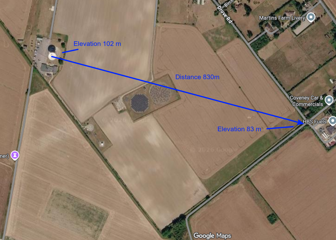
The most likely location for a beam 3 metres above ground
This invites the conclusion that the bottom of the beam is not level, as Pager Power have assumed, but that it points downwards by 1.1 degrees. If accurate, this has a significant effect on their calculations.
With the correct elevation of the transmitter at 102 metres and the bottom of the beam pointing 1.1 degrees downwards, the beam will come much closer to the homes.
| Point | Elevation | Clearance |
|---|---|---|
| Point 1 | 75 | 1.8 |
| Point 2 | 72 | 1.7 |
| Point 3 | 72 | -1.4 |
| Point 4 | 74 | -0.2 |
| Point 5 | 71 | 1.5 |
This perhaps may explain STFC’s concern. It shows the beam intercepting the roofs of two sites, and less than two metres above the other three.
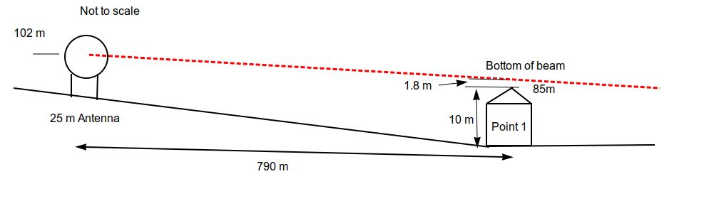
Alternative beam path
STFC’s case
Of course this, like Pager Power’s analysis, is desk-based work, albeit with a correction for the elevation of the dish, and using the additional information that the radar beam comes within three to four metres of the ground at some points within the Observatory’s plot.
It does however, show that the “fundamental evidential weaknesses” pointed out by Gregory Jones KC could well be addressed by STFC. In fact his opinion notes that correspondence from STFC on 21 May 2026 said that they were “settled on making a firm objection” and that they “could not compromise” because a large area was of “high concern”, and was “not something possible to mitigate.”
Of course, the information used here to determine the downward deflection of the beam dates from 2023. Upgrades are likely to have been made to the equipment, and we know that there are certainly others already scheduled.
The ball is now clearly within STFC’s court to apprise James Painter and his consultants, and TVBC planners of the substance of their objection.